random cascades
yet another desultory waterfall site with no claims to comprehensiveness
Bash Bish Falls

Bash Bish Falls

Bash Bish Falls
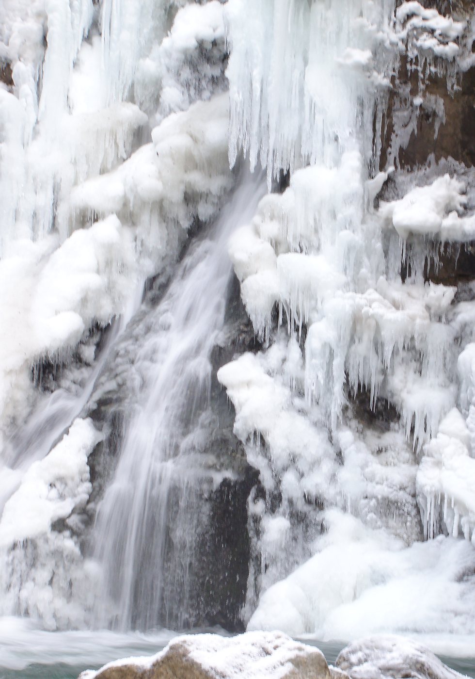
Detail of a semi-frozen Bash Bish Falls
Bash Bish Falls
Stream Bash Bish Brook
Greater watershed Roeliff Jansen Kill → Hudson River → New York Bay
Height The total drop is about 61m/200ft according to the topo maps. The main bit is a little smaller than the average pine tree.
Form A bunch of little drops you can't see without abseiling, then a big twin drop with a giant tooth in the middle
Volume Roary
General location Taconic Mountains, New York/Massachusetts border
Specific location a couple miles from Copake Falls, New York
Trail access Easy (15-20 min) graded walk from sizeable parking area on New York side; fairly steep 5-10 minute path from smaller parking area on Massachusetts side
I've been to this waterfall about six times, five of them during the exceptionally rainy summer of 2009, and still don't have photos I like.
Despite being in Massachusetts, this is basically a New York waterfall. The easiest access is from NY 23 in the Roeliff Jansen Kill valley, a quite scenic patch of Columbia County any time of year, following signs to Copake Falls. I'm not sure if there is an actual waterfall called Copake Falls anywhere around, or if this is the one that gave the town its name, but it's a nice one and whilst you're unlikely to be alone here unless it's bitterly cold or rainy there are lots of vantage points for dilettante photographers like myself to set up on.
The Taconics are basically a dissected plateau, and all the streams flowing off the west side of the plateau drain into Bash Bish Brook, so this fall can move quite a lot of water when it's been raining. On the other hand, during your normal summer, don't expect nearly as much water as I had. According to American Whitewater, people have taken kayaks down the stream below the falls, if you're into that sort of thing.
A tiny stream that drops into the big plunge pool from the river-right, which probably nobody but me ever pays attention to, supplied the photo for my front page incidentally.